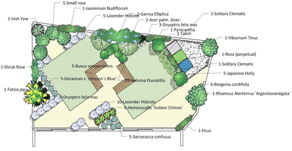
The main goal of garden designing and landscaping is to combine the functional and aesthetic aspects in order to make optimal use of each part of the garden. The aforementioned takes two main variables into consideration:
- The static data of the garden (land acreage, water source, building height, building style, exterior color);
- And the variable data (the budget for construction and periodic maintenance of the garden).
What information should one seek while preparing a landscaping project?
What information should one seek while preparing a landscaping project?
Studying the Garden Site
- Altitude of the site
- Soil type, is it (sandy, clayey, aerated, or compact), is it rich in organic substance or poor in its organic content?
- Presence of stones and construction waste at the site
- Surrounding buildings
Climate
- Cast an eye over the low and high temperatures in the region
- Wind direction and speed
- Humidity of the air
Water Source
- Abundance and permanence of the water source
- Is the water source a well or a storage tank?
- Is the irrigation method manual, or by using modern irrigation methods (spray, drip)?
Plants
Are they trees, shrubs, green spaces, or seasonal or perennial flowers? Flowering or green?
Garden design and landscaping steps
Sketch of the Site
Use a specific drawing scale depending on the acreage of the garden, where the dimensions of the land are transferred to the design paper with the indication of the North direction. On the sketch, fix the construction in relation to the garden, and then the garden axes, predefined paths, pre-planted plants -if any- fences, swimming pools, the entrance, the main and sub roads surrounding the site, and any other notes related to the site.
Draw a Site Map
- Start drawing an illustrative map of the site: either by using the traditional method on paper or by using one of the garden design programs such as Real Time Landscaping -the famous program in this field, which I will talk about in detail in addition to how to design gardens using it in this series
- Identify the locations of plant fences, trees, shrubs, green areas and flower pots, which are called (Softscape), as well identify the hard parts or what is called (Hardscape) such as benches, statues, water fountains, or any figures that may be in the garden
- Identify the light reflections on the garden

Implementation
After completing the mapping and locating the plants on it accurately as well identifying all the fixed and variable data and the hard parts in the garden, we proceed to the implementation, which is transferring what is on the map to the ground

